I have not slept well in the Gites. I Do not know why, I never had any trouble before. Once again the dortoir was full. This one was a little more basic, pairs of mattresses side by side on bunk beds. My mattress mate was a French woman, so no communication was possible. Lest you think anything salacious occurs in these establishments let me re-assure you it doesn’t. We all have sheet sleeping bags (in my attempt to save weight I bought a silk one, v v comfortable). We then have a duvet each. The pillow is rubbish, maybe that is why I can’t sleep.
At 6am people start to get up and pack their rucksacks ready to start straight after breakfast. I was on my way by 7:30, heading in the other direction to the TMB walkers who usually circumnavigate the mountain in an anti-clockwise direction. The church was outlined by the Trient glacier

I walked through the village and crossed the road to start the climb up to the Col de la Forclaz. The track was the original ox road between Trient and Forclaz. It cost 4,100 francs to build. In 1912 cars were allowed on the road, but only at certain time and not at night. They were limited 18kph except when going round corners or through villages when they at to travel at the pace of a horse’s step.
I reached a path junction and had to decide which way to go. I chose the easier (Bovine) route rather than the Fenetre that I alluded to in yesterday’s blog, partly to protect my knee and partly because rain was forecast for the afternoon. Visibility would have been poor. I continued up to the Col de la Forclaz alongside a bisse, which is a man made stream used to divert water from a glacier to a village or for irrigation. There was a good view down to Trient.

From the col the path continued through climb through meadows and woodland. There were good views down to the Rhone valley in the distance with Martigny in the mid-ground. In the distance mountain tops could be seen peeking above the cloud inversion.
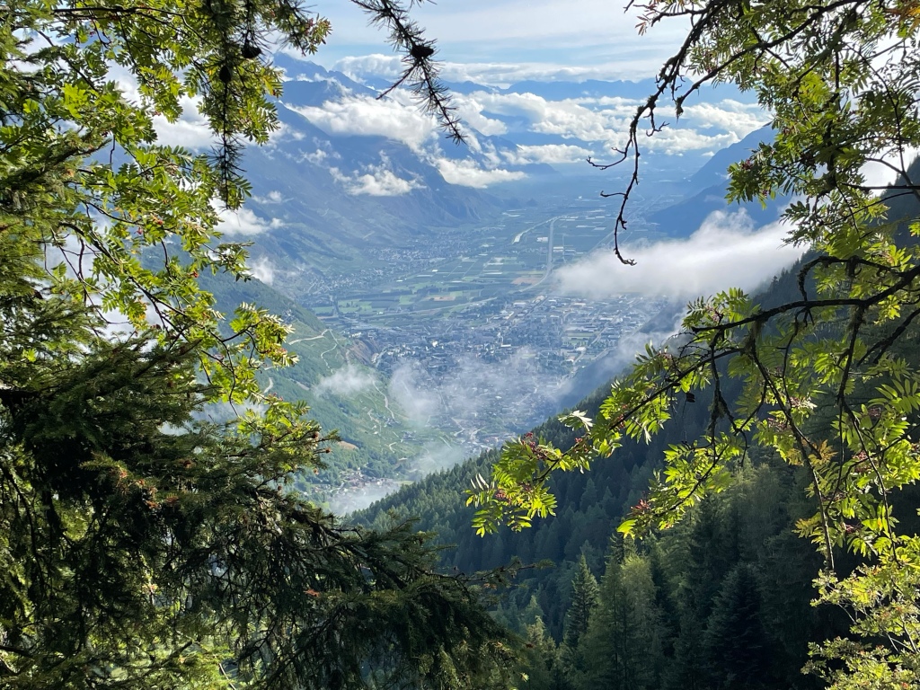
The path now went through woodland on the north slopes of the Croix des Prelayes climbing, usually with a moderate gradient, up to Alp Bovine. The view down to the Rhône valley was often visible through the trees. I came to a clearing in the forest and it was obvious that the cloud base was thickening and descending. I re-entered the trees, climbing more steeply now. Martigny and the adjacent farmland could be seen through a gap in the trees

I emerged from the forest at Alp Bovine, the highest point on today’s walk at 2049 metres. Down below, in the pasture land was the building of Alpage de Bovine and in the distance I had my first view of the sniw covered Gand Combin massif.

I descended to the hut and had apple pie and coffee.

The owner was impressed that I could speak some French. Now, my French is pretty awful so that must mean most English speakers do not even bother to try. A cow bell had been recycled

Presumably it clangs at dawn rather than crows. By the time I had finished eating the tops were all in cloud. I set off hoping to reach Champex before the rain that was forecast for late afternoon. The next group of walkers to come up the hill and pass me were from Saudi Arabia, a truly international day. I re-entered woodland and began to descend steeply. My knee tolerated this much better than yesterday, even though it was another long descent.
I crossed two waterfalls but managed to keep my feet dry. Eventually the path became a farm track. Just below the farm I took a path that climbed gently through woodland to emerge at Champex d’en Bas. I walked through this village and then began the gentle climb along road to Champex d’en Haut

The refuge was at the top of the village. Another international evening was spent eating fondue with two South Africans, one of whom now lives in Neufchâtel, and a man from the Chinese/North Korean border who lives in Singapore. After dinner it was time to struggle with today’s Wordle (twang!) with a group of Americans.
